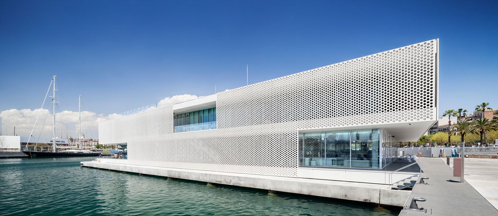
OneOcean Port Vell — the Gallery. SCOB Arquitectura i Paisatge, 2016 · photograph © Adrià Goula. Shown as the place, not as my work: this is the marina where the training and the crew placements happened, and no part of these buildings is mine.
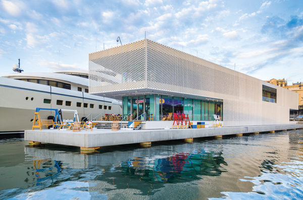
OneOcean Port Vell — the Club. SCOB Arquitectura i Paisatge, 2016 · photograph © Adrià Goula.
Entry
009 / 41
Project
BWA Yachting
Date
2019
Location
Barcelona, Spain
Coordinates
41°22'38.496"N 2°11'13.337"E
Status
COMMISSIONED
Info
I recruited superyacht crew off these pontoons for a season; it left me my first client list and a habit: ask the draught first.
See also 013 TNMT
← 008 · 011 →
Close ×
35
4
6
4
55
75
5
55
8
45
8
85
8
7
6
55
35
55
45
3
65
4
55
7
35
6
65
45
65
65
5
45
5
4
3
5
5
5
65
4
35
SUPERYACHT BERTHS, STERN-TO
L’ESCAR 26
B
L’ESCAR 20
27 CM
1 M
B · THE LANDMARK
L’ESCAR 20 · THE SCREEN
SCALE BREAK ×12
2°11.0′E 2°11.1′E 2°11.2′E 2°11.3′E 41°22.5′N 41°22.6′N 41°22.7′N 41°22.8′N 41°22.9′N
N
TRUE NORTH
NO VARIATION APPLIED
0
50
100 m
ONEOCEAN PORT VELL
MARINA PORT VELL · BARCELONA · 41°22′.7 N 2°11′.2 E
INDICATIVE DEPTHS IN METRES · NOT FOR NAVIGATION
CHART No 009 · © 2026 LAIZIG · 1 CHART UNIT = 1 METRE
HARBOUR © OPENSTREETMAP CONTRIBUTORS · ODbL
BUILDING B BY SCOB ARQUITECTURA I PAISATGE, 2016
ITS ROOF TRACED FROM THE ICGC ORTHOPHOTO · CC BY 4.0
DEPTHS, BERTHS, FLEET AND CREW: THE AUTHOR’S RULE OF THUMB, NOT A SURVEY
DETAIL B IS A SCALE BREAK AT ×12 · ALL ELSE 1:1 WITH THE GRATICULE
MOLL DEL DIPÒSIT
MOLL DEL RELLOTGE
CHART No 009
Inset A. The subject hull in true-length elevation, alongside the west quay, with her waterline, her draught and the seabed under her; beneath, the crew she carries drawn as a population by department, with the watch that covers all twenty-four hours.
A · THE TOWN ABOARD
CREW: INDICATIVE, NOT SURVEYED
THE HULL IN ELEVATION · ALONGSIDE THE WEST QUAY
DRAWN TO A RULE, NOT SURVEYED
88 CREW ABOARD 156 M LOA
0
60
120
180 M
ON WATCH, HOUR BY HOUR — SHIP’S TIME
BY DEPARTMENT
00 06
12 18
24
THE SHADED HOURS ARE THE NIGHT. THE BAR NEVER REACHES THE BASELINE.
The town aboard. The hull is drawn to a rule at her stated length; the crew numbers and the watch pattern are mine, interpolated from yard rules of thumb — indicative, not a crew list.
LENGTH
156 m
A hull of 156 m carries about 88 .
B · THE MIDDLE BUILDING
ONE SCALE THROUGHOUT
ROOF PLAN · TRACED FROM A 5 CM ORTHOPHOTO
N 73 M ALONG THE NORTH FACE
NO POINT AT THE WEST END — THE BOW IS BLUNT, 8.6 M ACROSS
A SUNKEN COURT DOWN THE WEST HALF · PLANT AND 106 PANELS ON THE EAST
38 M DEEP
1,674
M² OF GROUND
3,348 M² OVER
TWO LEVELS
ELEVATION ON THE BASIN · THE SOUTH FACE
1.75 M
≈9.6 M
65 M ALONG THE SOUTH FACE
END ELEVATION · THE EAST FACE
42 M
02
01
02 IS A PERFORATED
SHEET, WRAPPED RIGHT
ROUND · 01 IS GLAZED
0
20
40 M
ROOF TRACED FROM A 5 CM ORTHOPHOTO © ICGC · CC BY 4.0 — NOT IN OPENSTREETMAP
PERFORATION PITCH 27 CM, MEASURED OFF A PHOTOGRAPH · HEIGHT ASSUMED
THE SAME ROOF SITS ON THE CHART AT TRUE SIZE, KEYED B
L’Escar 20, the middle building. SCOB Arquitectura i Paisatge, 2016 — not my building and not my design. Footprint and roof traced from the ICGC orthophoto; the height is mine, assumed.
DRAUGHT
4.0 m
Every berth against its own sounding.
Press a hull for her record. Click the water for the sounding under it.
What is drawn and what is guessed. The coast, the quays and the pontoons are traced from OpenStreetMap, © OpenStreetMap contributors , under the Open Database License (ODbL). Building B, L’Escar 20, is SCOB Arquitectura i Paisatge’s pavilion of 2016; my drawing of it is traced from the colour orthophoto of the Institut Cartogràfic i Geològic de Catalunya (ICGC), used under CC BY 4.0 , as is the strip of quay drawn round it. The depths, the berths, the hull lengths and the crew numbers are mine, and are not a survey.
© 2026 Laizig. The chart, the drawings, the text and the interactive code are mine; all rights reserved. The harbour data, the orthophoto and the architecture credited above stay their owners’ and keep their own terms.
The record
L’Escar 20, how it was drawn. The building is SCOB Arquitectura i Paisatge’s, 2016; the drawing is mine. It is not in OpenStreetMap: footprint and roof are traced from the ICGC colour orthophoto (CC BY 4.0), the screen’s 27 cm pitch is measured off a photograph, and the height is assumed.
The wedge at L’Escar 26, in full. It is drawn on the chart, unkeyed, because it stands next door. The record I traced puts no architect on it, so neither do I; it is older than the two low pavilions along the front, which are SCOB Arquitectura i Paisatge, 2016. It is not the building I worked and studied in — that is L’Escar 20, the middle one, keyed B and drawn with its footprint and its roof.
What is sourced and what is not. Coast, quays and pontoons are traced from OpenStreetMap, © OpenStreetMap contributors, under the ODbL. Building B is not in OpenStreetMap: it is traced from the ICGC orthophoto under CC BY 4.0, and the architecture is SCOB Arquitectura i Paisatge’s. Depths, berth positions, hull lengths and fleet positions are the author’s and are not a survey. Crew complement and the watch pattern are indicative, as declared above and on the chart. The photographs at the head of this entry are the marina’s own pavilions, photographed by Adrià Goula — shown as the place, not as the work. The chart, the drawings, the text and the code are © 2026 Laizig.